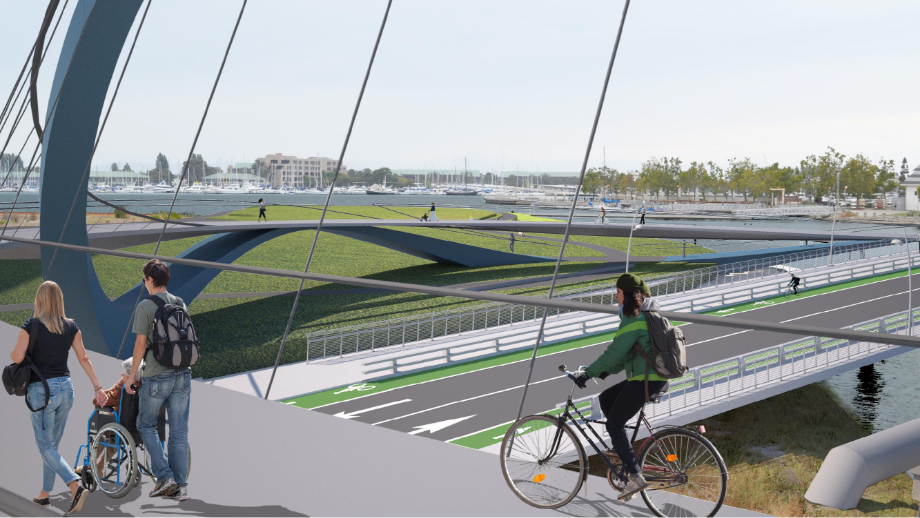


The Lake Merritt to Bay Trail (LM2BT) Connection will close a key gap in the regional pedestrian and bicycle transportation network. Since project inception in 2014, the project team, in collaboration with the City of Oakland, local agencies, and community stakeholders, have selected and refined a preferred location and layout for the bridge. Starting at the Lake Merritt Channel trail near 7th Street, the S-shaped bridge will thread under the I-880 freeway, and cross Lake Merritt Channel twice before flying over the Union Pacific Railroad tracks and the Embarcadero roadway.
The LM2BT project will provide a safe, grade-separated, ADA accessible route that will connect two important trail systems and waterways in Oakland - the Lake Merritt / Channel trails, and the San Francisco Bay Trail system. The project will improve transportation and recreation options for people of all ages and abilities, as well as link neighborhoods and destinations such as transit stations, Jack London Square, Chinatown, Brooklyn Basin, and the Oakland Estuary.


1) Site Identification > 2) Project Constraints Analysis > 3) Alignment Alternatives > 4) Structure Type Generation > 5) Community Engagement > 6) Design Proposal
Site survey data > Rhino > SolidWorks 3D modeling > Project renderings and videos >
• Improve safety and accessibility for all types of non-motorized users.
• Improve connectivity by providing an efficient, inviting link to local destinations.
• Attract and accommodate a greater volume of pedestrian and bicycle users.
• Promote healthy lifestyles and a healthy environment.


Media: Site-specific research and analysis, precedents research, design alternatives and visualizations
Type: Gap Closure / Urban Design
Dimension: Lake Merritt to Bay Trail Connection
Budget: ATP (active transportation project) Grant Proposal Location: Lake Merritt Channel, Oakland
Project Manager: Shivang Patwa
Project Team: Moffat and Nichol, SGA Team and Sub-Consultants